Ураган «Лоренцо» влияет на океан за тысячи км от своего центра. Предупреждения о высоких волнах объявлены на северо-востоке Южной Америки и Малых Антильских островах. А в ближайшие дни это явление будет также наблюдаться на Больших Антильских островах, Багамах, Бермудах и Восточном побережье США. В настоящее время ураган находится в 2415 км к северо-западу от Азорских островов и пока движется на север со скоростью 17 км/ч. Скорость ветра оценивается в 185 км/ч, информирует Национальный центр США по слежению за ураганами (NHC).
Here are the 5 PM AST Sept 28 Key Messages for #Lorenzo, Which has Re-strengthened to a Category 4 Hurricane. pic.twitter.com/G1OU1kMhOD
— National Hurricane Center (@NHC_Atlantic) September 28, 2019
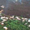
Жители острова Тринидад делятся в соцсетях видео больших волн в отсутствии ветра и солнечной погоде:
4:00 PM: Seas crashing over the Guayaguayare Sea Wall, Southern Trinidad.
Although the Hazardous Seas Alert extends for N & sheltered coastlines of T&T, swells from Hurricane #Lorenzo and king tides are producing coastal flooding across the islands.https://t.co/jOlONa45c5 pic.twitter.com/FJrppC6Dbs
— TTWeatherCenter (@TTWeatherCenter) September 28, 2019
3:25 PM: Seas crashing over the Guayaguayare Sea Wall, Southern Trinidad.
Although the Hazardous Seas Alert extends for N & sheltered coastlines of T&T, swells from Hurricane #Lorenzo and king tides are producing coastal flooding across the islands.https://t.co/jOlON9MtNv pic.twitter.com/HjvgPDqw89
— TTWeatherCenter (@TTWeatherCenter) September 28, 2019
Приливные наводнения уже наблюдаются на американских островах Флорида-Кис на юге штата Флорида:
Another day of tidal flooding in low-lying areas along the #FLKeys.
Some puddles may be from yesterday's rainfall, but more than likely consist of saltwater — avoid driving through if possible. #flwx
📷 NWS Key West Meteorologist, Bryce Tyner
📍 Riviera Dr/11th St, #KeyWest pic.twitter.com/usTFpty9Su— NWS Key West (@NWSKeyWest) September 28, 2019